Sunday, July 24, 2011

The Road Home

Scant internet access and a simple desire to be where I was at the time caused a drop off in blog updates for the rest of our trip to Oregon. Since I think it is silly to write multiple posts trying to document every place we went and recapture every aspect of our travels, I will simply post photos with some explanations and be happy with the extent of those memories now that we are home. I hope you will be too!


Crater Lake NP. It's impossible to take a representative pic of this gorgeous place without professional equipment!


Loverlies at Crater.


The bluest water ever.


Rogue River Gorge.


Grants Pass, OR campsite. Jump Off Joe Creek RV Park.


Happy pre-rafting trip in the somewhat cold AM. Low 60's.


A bird's eye view of other rafters on calm water.


Lunch time break shot on the shores of the Rogue.


O'Brien's Outfitters. Awesome family operation.


Dutch Bros coffee. I dig it. I am convinced I should start the first drive-up Pacific Northwest-style coffee shack in Milwaukee.


Rafting aftermath.


Our travel game. Thanks to Greta for giving me this awesome gift four years ago. It's gotten so much use over the years.


Ry studies something at the Riffle Cafe in Merlin, OR.


Why yes, this is Northern California. Why do you ask? Wink.


Ry tries attempts to eat all of our cherries before we have to give them up at the Cali border. He fails.


Snail in Redwoods NP.


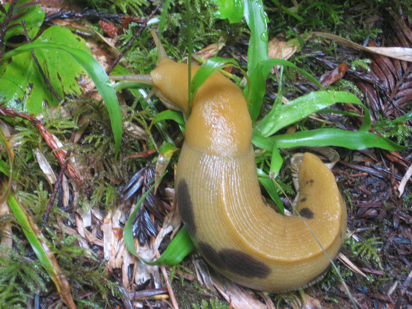
'Naner slug in Redwoods NP. I counted 32 on our short walk back to the car.


Knudsonmoblie with redwood.


Bridge over the Siuslaw River in Florence, OR.


Overlook near the Sea Lion caves on OR coast.


My buried feet with kite string.


A river cuts a path in the beach sand on its way to the ocean.


Ry watches playful sea lions.


I fly.


New kite to replace the one broken and lost over I-94.


Rogue in Newport, OR.


Bag of Rogue barley.


Shark's Seafood in Newport, OR.


Their famous Cioppino.


Bevery Beach State Park campsite.


Ry lies on Beverly Beach waiting for sunset.


Sunset under Hwy 101 bridge.


We hope you enjoyed your stay.


Hazard, hazard!


Astoria tower.


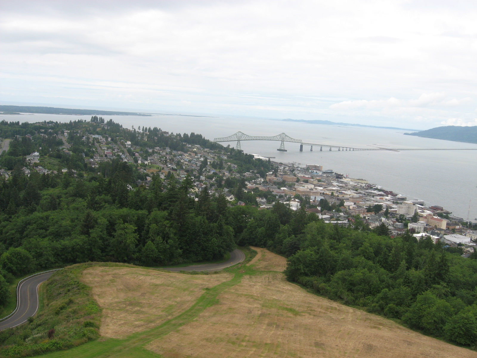
Columbia River valley from the tower.


Astoria, OR.


Fort George Brewing. Astoria, OR.


Tappers.


Reclaimed hardware and antique shop. Astoria, OR.


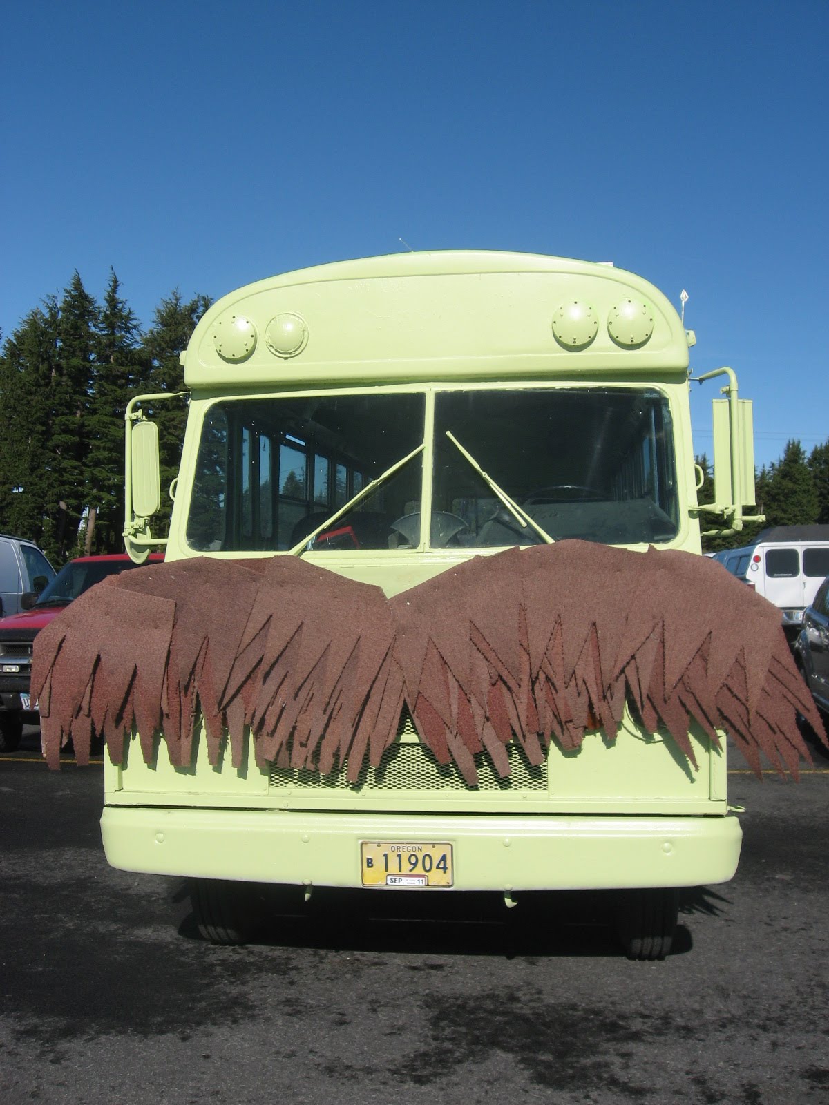
Oh hipsters. Bus at Timberline Lodge. Mount Hood, OR.


Above the clouds. Mt. Hood.


Free coffee at the Timberline Lodge. Mt. Hood.


What I'd give to stay with no one else there!


Floor.


WPA mural.


Up close and personal with Mt. Hood.


Bike ride on the old highway along the Columbia River Gorge. Near Hood River, OR.


Columbia River.


Cherry trees.


Fruitful.


Full Sail. Hood River, OR. Employee owned. Just sayin'.


Sampler.


Full Sail mural.


Some smarty pants amended Mr. Walker's sign around LaCrosse.

Thursday, July 14, 2011

Deschutes, Proxy Falls & Biking McKenzie Pass

The last few days have been A-mazing with a capital A! We've been on a pattern of camping it and hoteling it every other night which has been nice for access to showers and just a relaxing break in general, especially after doing physical outdoor things.

Yesterday we sipped coffee and walked around downtown Bend waiting for the Deschutes brew pub to open so we could do some sampling. We strolled along a path that followed the Deschutes River in a very lovely local park. We stopped at Mirror Pond, namesake of the Deschutes Pale Ale. There were families feeding ducks and riding bikes. Overall it was an extremely peaceful morning.

We made it back to the brewery just before the noon time rush so we were able to snag a great outdoor table. We each got a very reasonable tasting sampler that allowed us to sample six beers. Mine got sort of mixed up and out of order and there were a few that we weren't quite sure what they were.

I ended up drinking a magical mystery beer last. It was absolutely delish with just a hint of north woods pine needle scent. We consulted the waitress to try and find out what it was 'cause it didn't seem to match the profiles of anything I ordered. She smelled it and identified it. She brought us another small sampler of that beer to confirm, but it wasn't right. We ended up repeating this process several times and none of the ones she brought matched it. We tipped the waitress heartily for her efforts but were not able to identify it. So, it will always remain the magical mystery beer.


City symbol in an old building's leaded glass window.


View of Mirror Pond from the park.


All smiles outside Deschutes Brewery.


Our tasting samplers side by side.

After lunch we headed out of Bend toward the West hoping to camp near McKenzie Pass, which we planned to bike. We found a great site at a State Forrest campsite called Ice Cap and set up camp. There was hardly anyone there and we had a lot of space, but no running water. We made the best of it brushing our teeth and washing our faces from gallon jugs we bought at the merc down the road.


Our campsite at Ice Cap.


Our little breakfast set up.

By the time we had camp set up it was too late in the afternoon to do our planned bike ride so we decided to visit Proxy Falls instead. Ry had been there before during his high school years on a vacation with his family. It was an easy hike with a couple of tricky climb-down descents to get good close up shots of the falls. For such wonder, it was amazing that there was only one other hiker there with us. I assumed there would be lots of other folks there but it was our lucky day.


Tree hugger #1 on the trail to Proxy Falls.


Tree hugger #2.


Rhododendrons on the trail.


Upper Proxy Falls from the pool at the bottom.


Lower Proxy Falls from a distance.


Mossy rocks at the bottom of Lower Proxy Falls.


Holy amazing! A misty shot standing in the pool beneath the falls.


Our classic self-shot beneath the falls. Also, quite misty.

After our trip to the falls we made sandwiches for dinner and played Scrabble by the campfire until we hit the hay with the sound of a rushing creek to lull us to sleep!

In the morning we broke camp and dressed for a mega bike ride up McKenzie Pass. Ry had heard it was the last day that the road would be closed to cars before it opened for the season, a perfect day for bikers to ride up. It was sunny and cool, just the weather we needed for the 22 mile ride. Ry kept saying that it was going to be the hardest and best bike ride we've ever done. When we reached the point where the road was closed off, we parked and started the ride up.

My first clue that this was going to be extremely hard should have been the fact that there were no other casual riders there. Everyone else had their super road bikes and all their fancy bike gear. That worried me a bit. We started up and it was instant pain after the first hundred yards. We kept going and I reached a certain point where I understood just how hard this was going to be. That's when the expletives started flying out of my mouth and I kept saying to Ry over and over that I couldn't do it. That phase lasted about a mile.

After that mile I just sucked it up and kept going. We rode up for about five miles of switchbacks up the mountain stopping about every tenth of a mile to rest. It was painful and my lungs were screaming out for air at elevation but we made it through the tough ones that way. After those first five we hit some lava fields and things generally leveled off with a few moderate climbs, but nothing like the switchbacks. Every now and then there would be other bikers going by and there were Forest Service people getting the road ready for opening the next day.

We started out in thick tropical forest complete with hanging moss and ferns. Eventually the trees thinned out and there was snow all around. At the very top we were surrounded by lava beds and almost no greenery. It was crazy to see how quickly things can change with a few thousand feet of elevation gain. When we reached the top of the pass we had panoramic views of multiple peaks including the Three Sisters, Mount Washington, Black Butte and others. We climbed the Observatory Tower made of lava rock and took it all in.

At the top I felt kind of out of place hanging with all of those serious riders, especially given the fact that I was on an upright comfort bike that wasn't made for an ascent of that nature. Nonetheless, it was a huge accomplishment and I almost couldn't believe it that I'd made it to the top.

The ride down was a sweet reward. Probably the greatest reward I've ever experienced in my life. What took us something like two and a half hours to ascend took less than a half an hour to descend. We didn't watch the speed too closely, but Ry says he clocked at least 35 miles an hour down one of the switchbacks. Jetting down switchbacks with cold mountain air streaming in my face, I felt like I was the star of a car commercial with no car in site...it was a proud day for me!


McKenzie Pass summit.


The Observatory from below with our bikes.


View of serious bikers down from the observatory.


Forest Service compass pointing out all the peaks visible from the tower.


Middle Sister look out window signage.


Through the Middle Sister look out window.


WPA carving depicting old car and Airstream trailer.


Photo op at the summit.


Sisters.


The ride back down. Yes, that's snow.

Exhausted and happy we drove back to Bend, but had little luck finding a hotel. We traveled down I-97 about a half an hour to the small town of LaPine where we are shacked up in an awesome suite at the Best Western. Tomorrow we head for Crater Lake and then eventually over to the Rogue River valley and up the coast. Yippee!

Wednesday, July 13, 2011

Jackson, WY to Bend, OR

We've spent a long few days on the road and I have been reminded just how far away Oregon is from home! Though spending hours upon hours in the car can be annoying, mostly it's lovely and there's something about knowing you are so far from home that makes the traveling feel real. You can't deny you're on vacation when you've driven fifteen hundred miles from your front door.

On our second day of driving we made it from Rapid City to Grand Teton National Park. We were hoping to camp at the Jenny Lake camp ground, but it was full so we ended up at Gros Ventres which was just fine and had nice views of the peaks. We set up camp late in the early evening and made for a new bike trail that follows the inner park road. Sixteen miles went by like nothing when focused on amazing panoramic views of the peaks.

After the ride we headed to Jackson for dinner at a restaurant and nano brewery that Ry had been to before called Thai Me Up (classy name, huh?). The beer was great and the food was nummy. We enjoyed sitting out on a little patio table. I'm sure Jackson used to be a rugged little mountain town, but now it seems overpopulated by rich folk dressed in worn down mountain clothes and everything looks a tad over-touristed.

My dad came on a trip out here a long time ago and he had this sweatshirt that he used to wear from Jackson Hole with a silhouette of the Wyoming cowboy. I remember that sweatshirt well and a coloring book he also got me from Sun Valley, ID full of mountain drawings to color in. Those items are both long gone now. But, I can't help but thinking that Jackson isn't at all the same as it must of been back then.

The ride, food and beer tired us right out and we hit the hay right away. Unfortunately I had scary and strange post-apocalyptic dreams which kept me awake most of the night and I woke up in a sweat in the morning.


My toesies on the windshield. Ry does not love this because it leaves little toe prints but it helps me stretch out on long rides.


Grand Teton beer in the Cowboy Cafe. DuBois, WY on the way to GTNP.


A shot in the other direction.


Sign at a look out on the way into Jackson Hole.


View from the lookout.


In bike regalia at the creek on the path.


Morning view of the peaks.

The next day we had organic breakfast at a little health foods store where we realized that Ry never got his credit card back from our waiter the night before. We decided to head for OR anyway because they wouldn't be open for several more hours and we didn't have time to waste on our journey. Ry got them on the phone around lunch time and told them to cut the card up. Casualty of the road!

We traveled across all of Idaho and got onto Highway 26 a remote road that runs about 350 miles from eastern to central Oregon. I slept for a good deal of the first hour and woke just as the scenery was changing. Eventually we rode through extremely remote forests and watched the landscape change from sage brush scrub desert to high desert to mountains and back. We went through a few tiny valley towns but overall it was amazingly unpopulated. It was long, but I am so glad we took it. We rolled into Bend around 10pm and hit the hay in a cheap, shabby but clean motel on the outskirts of town.

Today we will find a campsite and try to decide what we will do since we learned the mountain we intended to climb, South Sister, is still covered in 5-7 feet of snow at the top. We're learning that lots of peaks are still full of snow and some passes are even still closed due to a rough winter. We're contemplating trying to ride a few passes on our bikes that are closed for cars, but that seems sort of ambitious to me. We may be heading down to Crater Lake and over to the coast sooner than we thought. We'll see...


View from an overlook down into the John Day Valley on Hwy 26.


Wagon!


John Day River along Hwy 26.

Ry roars.


Climbed up some rocks before the monument.


Me too, but looking the other direction.


Our bikes raked to the car on Hwy 26.

Monday, July 11, 2011

Summer Road Trip 2011

We embarked on our fourth annual summer road trip this morning. Until last night we were not sure where we'd head or what our plan would be. We knew we'd go west and were kicking around the idea of hitting Wyoming and Colorado or alternately Oregon.

Initially we were reluctant to drive as far as Oregon, but after thinking about the experience I really wanted, Oregon made my heart swell. We've been watching the Ken Burns documentary on the National Parks which is fresh in my mind and Crater Lake has been a wish for me since we came out to the Pacific Northwest last time but didn't make it to the big lake. So, we decided we are going to hit southern Oregon including Bend, Eugene, Crater Lake, Roseburg wine country, the coast and possibly into Cali redwood territory.

We didn't get a super early start but made it on the road with delectable Alterra iced coffee and our bikes hitched to the top of our car by 9am. I knew the bikes would reduce our usually excellent mileage, but I did not anticipate a reduction as large as 8-10 miles per gallon. We have vowed to make the trip with the bikes worth it by justifying their presence with some significant rides.

On the ride we jammed out to Ryan Adams (live and studio), Neil Young, Glossary and Wilco. We hit a Mexican restaurant in Mitchell, SD for dinner and made it to Rapid City, SD by 10:30pm. After much inspection of our atlas and quite a bit of healthy discussion we've decided to drive a bit longer to go through the Tetons. Next stop, Jackson, WY.